The Latest

Traffic Survey in Dubai, UAE, Abu Dhabi

Are you looking for Traffic Survey Company in india? Need, Traffic consultants for traffic surveys, AlwarqaSurvey is offering traffic engineering projects in UAE as per the varying demands of customers. We have an experts subjected to regular training by experts in the field.

Our team specializes in traffic counts services as well as traffic surveys in Dubai. Traffic Data is a key factor for the transportation planning and decision making of Highways.

Traffic Engineering the sister firm of ALWARQA SURVEY ENGINEERING was established in 2015 by highly qualified and expert professionals , Alwarq Suvey Engineering The Company targets to deliver consulting services in the field of Survey Engineering, Traffic Data Collection, Environmental Studies, Traffic Impact Studies as well as quality field data collection with utmost accuracy. Our expert team is also capable of conducting large scale Transport Surveys required for developing city-wide transport demand models and manual Trip Generation. In addition, we offer full range of traffic engineering services.


CONCLUSION :

At Alwarqa Survey we provide the best TrafficSurvey Services with the newest technologies at an affordable cost and time. We will ensure an accurate Traffic Survey that saves you both time and money.
For More details visit Alwarqa survey or call us at : +971506975361 ,+971 42676170 or Mail Us at: aleem@alwarqasurvey.com alwarqa1@emirates.net.ae

YOU CAN ALSO VIEW GIS SERVICES WE PROVIDE.

GPR Survey in Dubai, UAE, Abu Dhabi GPR Survey uses the radar pulses to image the subsurface.This nondestructive method uses electromagnetic radiation in the microwave band (UHF/VHF frequencies) of the radio spectrum, and detects the reflected signals from subsurface structures.

GPR Survey in Dubai

GPR uses radio waves to built a picture of whats inside much like medical imaging systems.

This system sends out the pulse of radio frequency energy which bounces out the burried object and is detected by the reciever. AlwarqaSurvey Engineering has many years of experience in science and technology in terms of gpr. With the advanced technology system, we can determine the things like depth, size and object material characterstics. GPR is the standard technology in many industries around the world like construction, Engineering, law Enforcement, Mine Safety, Road and Building Maintenance, utility location, archaeology surveys, geophysics and other projects. infrastructure asset owners regularly monitor the interiors of concrete buildings and dams, bridges and runways to detect structural problems before them become safety concerns.

Law enforcement rely on critical evidence for burried bodies, weapons and cashes of drugs. Search and rescue team deploy gpr at earth quakes and avalanches to locate the movement of burried victims.


CONCLUSION :

At Alwarqa Survey we provide the best GPR Survey Services with the newest technologies at an affordable cost and time. We will ensure an accurate GPR Survey that saves you both time and money.
For More details visit Alwarqa survey or call us at : +971506975361 ,+971 42676170 or Mail Us at: aleem@alwarqasurvey.com alwarqa1@emirates.net.ae

YOU CAN ALSO VIEW GIS SERVICES WE PROVIDE.

Setting Out Survey in Dubai, UAE, Abu Dhabi

Setting Out Survey, usually used to set out the exact position of a proposed structure within the legal boundaries of a piece of land.

setting-out.o

Setting Out Survey in Dubai

This kind of Survey is very important when preparing for any type of construction work. A Set-Out Survey involves transferring a building design on to the land itself so the builders can follow it during construction. Key points are established and makers used to guide the building process and ensure accuracy. For Large projects such as High rise buildings and developments, multiple set-out surveys may be needed as the construction progresses. Examples of these would be for the earth-works, roads, car parks, Sewerage, water and the actual buildings themselves.


Why Are Set-Out Surveys important ?

  • They allow for the construction to be done within the legal boundary, which is vital to ensure no boundary disputes later on.
  • They enable the construction team to build exactly to plan as makers are physically laid out in front of them

Why Are Set-Out Surveys Needed ?

  • When building anything from a small dwelling to major commercial building or high rise
  • When building roads, bridges, tunnels etc.
  • When doing extensions to existing buildings.


How Do I get a Set-Out Survey ?

CONCLUSION :

At Alwarqa Survey we provide the best Gate Level Survey Services with the newest technologies at an affordable cost and time. We will ensure an accurate Set-Out Survey that saves you both time and money.
For More details visit Alwarqa survey or call us at : +971506975361 ,+971 42676170 or Mail Us at: aleem@alwarqasurvey.com alwarqa1@emirates.net.ae

YOU CAN ALSO VIEW GIS SERVICES WE PROVIDE.

Gate Level Survey in Ras Al Khaimah, UAE, Dubai, AbuDhabi

Gate Level Survey, is usually used for deciding the Gate Level of the Plot comparision to the closest As-Phalt Road/Ground Level.

Gate Level Survey in Ras Al Khaimah

In Dubai, There is necessity for each and evey plots to have Gate Level Survey (GLS) which is required by the government officials. There is a need for Online Doccumentation for the Survey that need to be approved.It helps the authorities to keep all building's ground floor elevation almost same in a particular area. At AlwarqaSurvey we provide all related approval and providing detailed report of the computation.The type of survey, whether by level equipment or by GPS will be instructed by the authority during submission of application of GLC. We will do the same including all documentations till get the approval of Gate Level.


NEED FOR THE GATE LEVEL SURVEY :

Gate Level Survey is useful for deciding the gate-level of the plot comparision. It is useful to check whether all the building's ground floor elevations are at the same level.


AlwarqaSurvey uses updated technology, research and innovation that are implemented by highly experienced and qualified staff to create Reports and maps.

CONCLUSION :

At Alwarqa Survey we provide the best Gate Level Survey Services with the newest technologies at an affordable cost and time.We are the experts in doing all kinds surveys and provides various services. For more details Reach us.
For More details visit Alwarqa survey or call us at : +971506975361 ,+971 42676170 or Mail Us at: aleem@alwarqasurvey.com alwarqa1@emirates.net.ae

YOU CAN ALSO VIEW GIS SERVICES WE PROVIDE.

GIS Services in Ras Al Khaimah, UAE, Dubai, AbuDhabi

GIS Service, Simply Speaking A geographic information system (GIS) is a system designed to capture, store, manipulate, analyze, manage, and present spatial or geographic data.

GIS Services in Ras Al Khaimah

GIS refers to variety of various technologies, processes, techniques and strategies. GIS can relate unrelated information by using location as the key index variable. Locations or extents in the Earth space–time may be recorded as dates/times of occurrence, and x, y, and z coordinates representing, longitude, latitude, and elevation, respectively.AlwarqaSurvey Engineering leverages the power of Geographic Information Systems (GIS) to analyze, manage, and display environmental data.We use GIS Service in 90% of our projects. Our GIS analysts are capable of capturing data from many different sources and in many different formats, including local, state, and federal datasets, aerial and satellite imagery, digital elevation models (DEMs), CAD drawings, KML & KMZ files, client files, and GPS data collection.


WHAT WE CAN DO WITH GEO GRAPHIC INFORMATION SYSTEM (GIS) AS A SERVICE :

GIS is a tool used in problem-solving and decision-making process and for visualization of data in a spatial environment.Our Team always works on GIS data conversions and prepares electronic maps using Geographic Information Systems (GIS) technology by utilizing the paper or electronic data that has been either captured by the clients or collected otherwise. The vast expertise and experience allows AlwarqaSurvey Engineering to integrate GIS, CAD and Global Positioning Systems (GPS) services, by using high-end GIS Mapping and GIS data conversions software. We can do the following with geographic information system (GIS) :

  • Data Analysis
  • Topological Modeling
  • Geometric Networks
  • Hydrological Modeling
  • Hydrological Modeling
  • Cartographic Modeling
  • Map Overlay
  • Geostatistics

ADVANTAGES OF GEO-GRAPHIC INFORMATION SYSTEM(GIS):

These are the following advantages of GIS Services:

  • Geographic Information Systems can visualize spatial information , It has the power to create the maps with the images
  • GIS technology offers time management. It has high accuracy , It presents higher predictions and analysis .
  • It allows us to view , understand , question , interpret & visualize the data in many ways that reveal relationships , patterns and trends in the form of maps , globes , reports and charts.

WHAT WE PROVIDE :

if you want GIS Service in Ras Khaimah, AlwarqaSurvey Engineering is the best option in terms of quality and productivity.We were one of the first survey companies in Ras Khaimah to offer GIS Services in ras al khaimah. AlwarqaSurvey Engineering provides GIS services with an all-inclusive solution for spatial data management to government and industrial organizations through GIS remote sensing services.


AlwarqaSurvey uses updated technology, research and innovation that are implemented by highly experienced and qualified staff to create maps.

CONCLUSION :

At Alwarqa Survey we provide the best GIS Service with the newest technologies at an affordable cost and time.We are the experts in doing all kinds surveys and provides various services. For more details Reach us.
For More details visit Alwarqa survey or call us at : +971506975361 ,+971 42676170 or Mail Us at: aleem@alwarqasurvey.com alwarqa1@emirates.net.ae

YOU CAN ALSO VIEW Topographical Survey and CAD & GIS Services in Dubai WE PROVIDE.

Underground Utility Survey in Dubai, UAE, Abu Dhabi

With Underground Utility Survey in Dubai we use Ground Penetrating Radar (GPR) system that gives cable and pipe surveyors worldwide the ability to see what’s underground.

Underground Utility Survey

Underground Utility Surveying is the process of mapping subsurface utilities using a combination of geophysical and land surveying techniques. Main Roads requires the collection of underground utility data for the purposes of planning, detail design, maintenance and construction. Each process requires differing levels of detail and accuracy with regard to the collection of this data.


NEED FOR UNDERGROUND UTILITY SURVEY:

Many benefits arise from having good quality mapping of the buried utilities of a site including:

  • Ensuring safety of both public and work force during construction work.
  • Minimizing cost and disruption arising from damaged to existing utilities.
  • Minimizing project delays.
  • Avoiding accidental damages to existing underground services.

ADVANTAGES OF UNDERGROUND UTILITY SURVEY:

These are the following advantages of Underground Utility Services.

  • This method can be adopted without disturbance to existing utilities.
  • Damage or mishap due to accidental breakup of services can be minimized or avoid.
  • Cost of repairing of damaged utilities can be reduced.
  • Land pollution on account of accidental damage services can be minimized.
  • Speed execution of infrastructure development work can be retained.

WHAT WE PROVIDE :

if you want Underground Utility Survey Services in Dubai, AlwarqaSurvey Engineering is the best option in terms of quality and productivity.We were one of the first survey companies in dubai to offer underground utility surveys and are considered experts in the field. Without the need of costly excavations,we use the technologies like Ground Penetration Radar(GPR),Radiodetection,and many other procedures to ensure we provide you with the most accurate and reliable underground utility service.


The traditional approaches for underground utility survey is time taking process and very costly. The advantage over a traditional, electromagnetic locator is that the RD 1000TM can see non-conductive materials including plastic pipes.We use RD 1000TM which is an powerful tool kit for utility services.

CONCLUSION :

At Alwarqa Survey we provide the best Underground Utility survey with the newest technologies at an affordable cost and time.We are the experts in doing all kinds of Surveys as Such we will offer you the underground utility Survey in dubai For more details Reach us.
For More details visit Alwarqa survey or call us at : +971506975361 ,+971 42676170 or Mail Us at: aleem@alwarqasurvey.com alwarqa1@emirates.net.ae

YOU CAN ALSO VIEW Topographical Survey and GIS Services in Ras Al Khaimah WE PROVIDE.

GPS Survey in Dubai, UAE, Abu Dhabi

GPS Control Survey provides surveying and mapping data of the highest accuracy.

gps-survey  in dubai,uae,abu dhabi

GPS Survey in Dubai

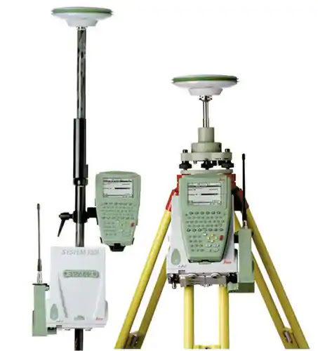
A GPS (Global Positioning System) management survey utilizes high exactness survey grade international Positioning Receivers to determine horizontal and vertical values for remote locations.Measurements can be determined without the necessity of a clear line of sight between points on the ground which enables the surveyor to work in extraordinary terrain and to cover large areas in an efficient and precise manner. GPS management surveys use the Global positioning system (GPS) satellites to calculate the points of a survey. The GPS system is formed of a network of satellites that orbits the earth and sends a sign to GPS receivers and Navigation devices, giving them an exact location, speed, and altitude.


GPS SURVEY TECHNOLOGY :

A GPS survey uses high exactness survey-grade international positioning receivers to ascertain the horizontal and vertical values for remote locations. These measurements is calculated while not having a transparent line of sight between points on the bottom. this allows the surveyor to figure out massive areas in an economical and precise manner. Alwarqa Land Surveying has extensive experience in applying Static GPS Surveys and Real Time Kinematic (RTK) Surveys technologies to a vast variety of projects including transmission line route surveys, topographic surveys and construction surveys.GPS mensuration instrumentation is employed to assemble the vertical and horizontal positions of existing options to form boundaries, geographics maps, enhancements and planned locations for construction.With our GPS receivers, the receiver nearly instantly calculates its position (Latitude, Longitude, and Height) with an uncertainty of a number of meters, from the info broadcast by the GPS satellites.

STATIC GPS SURVEYS :

Static GPS mensuration has been used on management surveys from native to wide extent,and will probably continue to be the preferred technique. Static GPS is used for determining accurate coordinates of survey points by recording GPS observations over a known and unknown survey point.

CONCLUSION :

At Alwarqa Survey we provide the best Global Positioning System (GPS) management survey with the newest technologies at an affordable cost and time.We are the experts in doing all kinds of Surveys as Such we will offer you the gps Survey in dubai For more details Reach us.
For More details visit Alwarqa survey or call us at : +971506975361 ,+971 42676170 or Mail Us at: aleem@alwarqasurvey.com alwarqa1@emirates.net.ae
YOU CAN ALSO VIEW DIFFERENT TYPES OF SURVEYS WE OFFER FOR OUR CUSTOMERS

Topographical Survey in Dubai, UAE, Abu Dhabi

Topographical Survey Useful in Surveying the land and its Elevations

Topographical Survey in Dubai

Topographical Survey in Dubai


Topographical Survey is the survey that gathers data about the elevation of points on a piece of land and presents them as contour lines on a plot.Topography describes the physical features of an area of land.When Developing any site or property, site engineer needs map of site indicating a wide array of relevant information. Exact ground elevations, roads, buildings and drainage features need to be taken in to consideration.Data from these surveys are useful for contouring the land and identifying the map of the property.Tropographical Surveys identify any existing features that could be slightly above, directly above, or below the surface of the earth,such as streets,buildings, manholes,retaining walls, and trees.


COST AND TIME:

Topographical Survey is one of the kind in surveying a land.Small resedential surveys are usually completed within 1 to 2 weeks.whereas, Larger commercial Surveys may take from 30 to 60 days,depending on the needs of the survey.Topographic maps play a major role in making a survey for a land. it uses a variety of symbols to describe both natural and human made features such as roads, buildings, streams and vegetation.Topographical surveys can be done at a affordable cost.For Simple survey, cost starts around $95,but can go as high as $600 depending on the amount of work requirement.Topographic surveys can also include natural objects such as trees, large rocks, as well as man-made features such as buildings, retaining walls, streets, driveways, landscaping and utility poles.

THE NEED FOR TOPOGRAPHICAL SURVEY :

Topographic land surveys have several uses. Nearly all construction comes begin with a topographical land survey, that describes the start line of the land before enhancements ar created. topographical surveys may additionally be used once making plans for evacuation ditches, grading or alternative options, victimisation the natural landscape because the basis for such enhancements. Government agencies may additionally need topographical surveys for any of variety of reasons—for example, as restrictive necessities for construction codes, or as a part of environmental restoration comes.

TOPOGRAPHICAL SURVEY PROCEDURE :

  • Establishment of horizontal and vertical management that ends up in the framework of the survey.
  • Actuating enough horizontal location and elevation of the bottom points to extract sufficient information for plotting once the map is needed.
  • Locating natural and synthetic structures that will be needed for the survey or different functions.
  • Calculation of distances, elevation, angles, and volumes of the rampart.
  • Finally, the last step is to draw the topographical maps.

CONCLUSION :

At Alwarqa Survey we provide the Topographical Survey as per the user requirements at affordable costs and time.We are the experts in doing all kinds of Surveys as Such we will offer you the Topographical Survey For more details Reach us.
For More details visit Alwarqa survey or call us at : +971506975361 ,+971 42676170 or Mail Us at: aleem@alwarqasurvey.com alwarqa1@emirates.net.ae

YOU CAN ALSO VIEW DRONE SURVEY AND IT'S IMPORTANCE.

Drone Survey in Dubai, UAE, Abu Dhabi

Drone Survey Useful In Advanced Civil Engineering And Surveying

Drone Survey in Dubai

Land surveying has always been a challenging and complex job. Previously land surveying was done with different techniques which include manned flights, satellite data, GPS receivers, robotic total stations and 3D scanners, Today the use of Commercial drones or UAV’s (Unmanned Aerial Vehicles) for land surveying has become a common practice.


Drone surveying is comparatively cheaper than other conventional surveying techniques. Drones are very useful in mapping applications like: Automated mapping, Cadastral Surveying, and volumetric calculations. Drone application have majorly reduced traditional efforts of surveying. They are useful in wide variety of applications like aerial surveying, policing, in industries, farming, gaming and in many other sectors.Drones play a major role in surveying. They can reach and hover above specific sites. Site Scan is a perfect solution for surveying and mapping drones. You can perform topographic surveys in minutes using our autonomous flight modes with any supported drones. Since its inception, AlWarqaSurvey has been carrying out many drone missions around the world. From quarry surveys to building inspections, to mining and lagoons exploitation. AlWarqa drones are used in many applications.

Aerial Survey:

With manned Helicopter or fixed-wing plane, the survey becomes time taking and tedious. These traditional approaches can take weeks or months to get data and results with high cost of expenditure. But, with a mapping UAV, the survival data gets very easily in a short span of time with much lower cost. Thereby producing dramatically faster, safer, and cheaper results.

Travel Budget and Other Expenses:

Normally, the companies bear lot of expenses to fly clients and other machinery to the sites for surveying manually. But with drone survey, everything is easy to collect the survey data and to transfer it remotely. Drones can also be useful in "mapping, GIS, aerial photography, video, and surveying. From this, we clearly understood that with the help of drone technology, we can rectify the minor mistakes and loopholes that can be overcome with drones.

BENEFITS OF DRONE SURVEY OVER TRADITIONAL APPROACHES:

  • Collecting Land data or normal survey data using traditional surveying methods is still the time-consuming process. Whereas, the advancement of drone technology is changing the nature of a land surveyors role and effectively allowing them accomplish more in less time.
  • The advancement of UAV Technology allows the surveyors to collect the real-time geospatial data

CONCLUSION

At AlWarqaSurvey, we provide the best surveying system with the help of drone survey. You will get benefited with our fastest approach in the field of surveying to get required surveyed data in less time with the affordable costs. So Dont Miss the Opportunity. For More details visit Alwarqa survey or call us at : +971506975361 ,+971 42676170 or Mail Us at: aleem@alwarqasurvey.com alwarqa1@emirates.net.ae

3d Laser Scanning in Dubai ; UAE | Details & Importance

Importance of 3D laser scanning & BIM technology

importance-of-3d-laserscanners

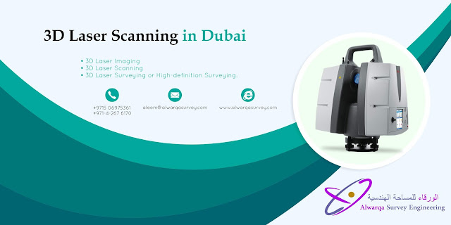
3D Laser Scanning is a revolution in the field of research and designing..3d Laser Scanning is the best Option for those who want the services in the field of surveying. At Alwarqa Survey We provide the best services which Includes 3d Laser Scanning.

APPLICATIONS AND USES OF 3D LASER SCANNING IN SURVEYING

  • 3D laser scanning is a great choice to overcome complex surveying challanges.
  • 3D Laser Scanning is used in numerous applications: industrial, architectural, civil surveying, urban topography, mining, reverse engineering, quality, archaeology, dentistry, and mechanical dimensional inspection are just a few of the versatile applications.
  • 3D Laser Scanning is used in the field of Construction Industry and Civil Engineering As-built drawings of Bridges, Industrial Plants, and Monuments,Site modeling and lay outing,Quality control etc.
  • 3D Laser Scanning is used in the field of Medicine in order to capture the 3D shape of a patient in orthotics and dentistry.
  • Accurate modeling of machinery, for example factory plant, ducting and for the oil/gas industry.
  • Engineering excavation models of land fill, mines and quarries for volume calculation.
  • Recording archaeological artefacts and features.
  • Building Information Modeling (BIM) using laser scanner, avoids spatial conflicts when installing new plant systems to old buildings.
  • 3D visualisation and modeling.

BENEFITS OF 3D LASER SCANING AND BIM TECHNOLOGY

3D laser scanning provides the as-built information to meet the MEP and architectural needs of the project team. For example, the scanners can collect location information about the MEP systems running in the ceilings and other inaccessible areas. From this information, contractors can use clash detection to determine exactly what must be moved or removed during the renovation. By knowing what is there in the beginning, this significantly reduces the potential for change orders later in the process—saving the Owner time and money.

CONCLUSION

At Alwarqa Survey we provide various services. 3D Laser Scanning is one of the best service we provide for those who want survey in different fields.We are the best company providing surveying services and we are in this domain providing unparallel quality In our Surveying services. We are the one who provide 3D Laser Scanning Survey at an affordable cost (2980 AED per day)in the market So Dont Miss the Opportunity. For More details visit alwarqa survey or call us at : +971506975361 ,+971 42676170 or Mail Us at: aleem@alwarqasurvey.com alwarqa1@emirates.net.ae
3d Laser Scanning in Dubai, UAE, Abu Dhabi

3D Laser Scanning In Dubai

3d laser scanning in dubai

In the field of surveying and metrology,3D Laser scanning plays a prominent role.3D Laser scanners are rapidly used for acquisition of geometric information in various sectors and for different fields of application. 3D Laser Scanning is a non-contact, non-destructive technology that digitally captures the shape of physical objects using a line of laser light.

WORKING OF 3D LASER SCANNERS

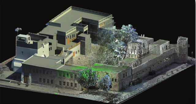
3D laser scanning uses light rays to collect the 3D location of every object and surface it can “see.” The scanner automatically rotates 360 degrees on a tripod and sends and receives lights rays in all directions. The data collected provides a near perfect 3D as-built of the existing conditions. That data can then be used by itself or modeled in a software program to interface with BIM, such as Revit.

3D scanning is the process of analyzing a real-world object or environment to collect data on its shape and possibly its appearance.The collected data can then be used to construct digital 3D models.LASER SCANNING is a relatively new technology, having been used as a precise survey instrument only. Now, it is quickly becoming the new industry standard as a way to make very accurate measurements in complicated environments.Alwarqa Survey Engineering provides one of the services like 3D Laser Scanning.We provide the service 3D Laser scanning in dubai,UAE and Abu dhabi.

USE OF 3D LASER SCANNERS IN BUILDING SURVEYS

With the manual measurements and surveying,Everything becomes tedious and it's a time taking process.But with 3D Laser scanning we can create Highly accurate 3 Dimensional Models. We start by Positioning the 3D laser scanner in the sight to be captured and will run the scanner to capture the first scan of the building.To capture the scanned data,the scanner uses the laser that is bounced off of the spinning mirror.Like wise,The 3D Laser Scanners are used in surveying the buildings Interior and Exterior.

USE OF 3D LASER SCANNERS IN HOSPITALITY SERVICES

3D Laser Scanning allows architects and engineers to design renovations from perfect as-built information.This directly addresses the need of accuracy within the tight tolerances in fields such as Health care and Hydrocarbons.Since human measurement error is eliminated, re-designs are greatly reduced and errors and omissions on the construction and architectural plans are eliminated. The strengths and efficiencies of 3D laser scanning are extraordinarily applicable to the unique environment of healthcare facilities. From design through construction and facilities management, all parties benefit from the precise as-built information given by this remarkable technology.


Why 3D Laser Scanning Is Important?